HISTORY OF CHAPMANVILLE, WV.
Long before Chapmanville became a town on a map, it was a river-valley crossroads—a place shaped by the Guyandotte River and the steep ridges of what is now Logan County. As settlement in the county accelerated between the 1790s and the 1820s, families built lives around subsistence and small-market farming, seasonal timber work, and moving goods along the river in a landscape where roads were limited.
Official state reference material highlights early settler families in the Chapmanville area as the Ferrells, Chapmans, and Dingesses, anchoring the town’s “founding family” tradition in a verified public record.
The River as Road, Timber as Livelihood. In the earliest era, the river wasn’t just scenery—it was infrastructure. An 1848 survey of the Guyandotte watershed documented timber and coal resources and even recommended locks and dams to improve navigation. A navigation company began construction, but the effort ran into engineering problems, legal disputes, repeated flood damage, and bankruptcy; a major flood in 1861 ultimately destroyed the navigation project.
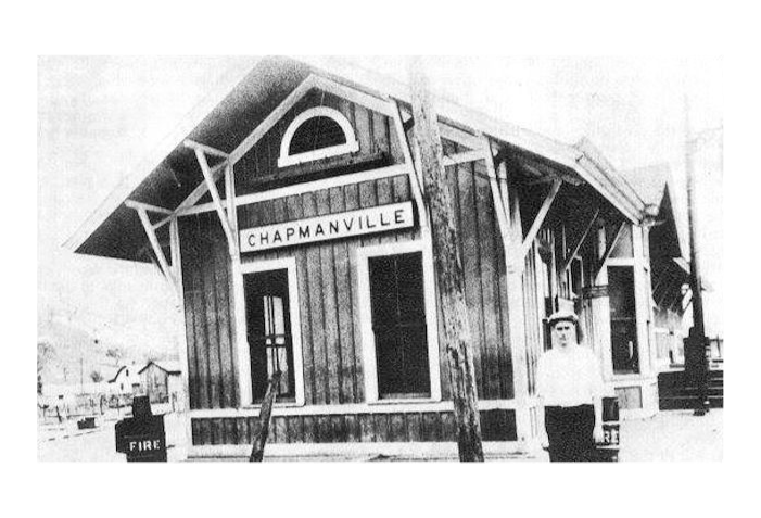
Even without full navigation works, the river remained a working transportation corridor: logs floated downstream, farm goods moved on rafts, and manufactured goods could come upriver by pushboats and small steamers. In this way, Chapmanville’s earliest identity formed as a valley node—a natural gathering point connecting hollows, tributaries, and upstream households to the main corridor of trade and travel.
Rails, Coal, and a Re-shaped Valley.
As transportation technology changed, the valley changed with it. County-level historical synthesis describes the railroad era as the hinge point that ended the period when Guyandotte river commerce was central and set the stage for coal to become the dominant business in the watershed.
During the coal boom (especially in the early 20th century), many places in the region became single-industry coal settlements. Chapmanville, however, fits a different pattern common to coalfield geography: valley towns that persist because they sit at strategic transportation nodes and grow into administrative, retail, and service centers—supporting schools, merchants, and public life even as the wider economy shifts.
Kanawha Gap
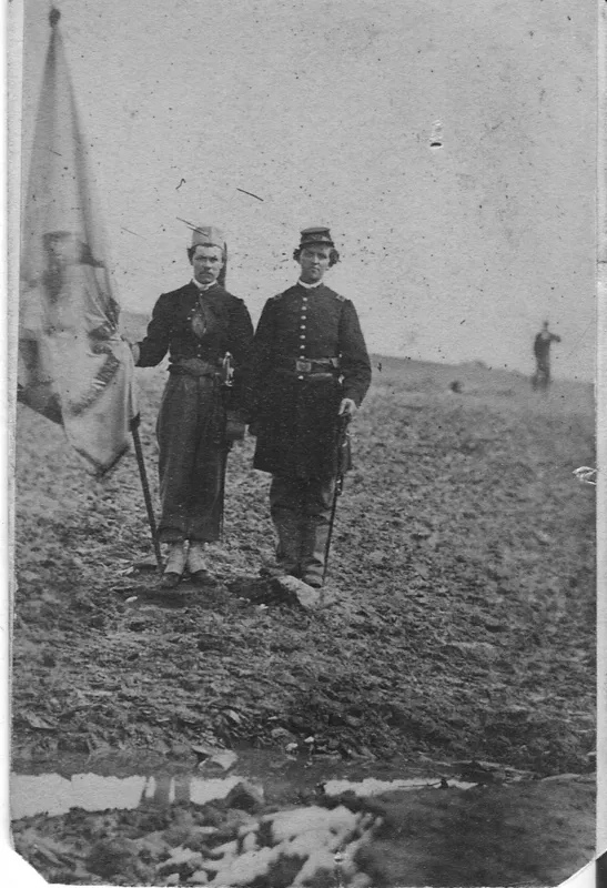
Chapmanville is directly connected to Civil War history through the state highway marker titled “Battle of Kanawha Gap,” located at the Chapmanville exit just off US 119 South. The marker identifies the action as occurring on September 25, 1861, and describes militia activity and a retreat/capture-and-parole episode involving Col. J. W. Davis.
Mine Wars, Labor Conflict, and a Harder History.To understand Chapmanville in the 20th century, it must be placed in the wider story of the southern West Virginia coalfields—an era marked by labor organizing, political conflict, and violence associated with the coal economy.
The record also includes a painful fact that belongs in any honest public history: a statewide African American history synthesis documents that in 1919, a white mob lynched two Black miners in Chapmanville, tying the town to the broader history of racial terror and coalfield social conflict.
Incorporation and Modern Civic Identity
Chapmanville’s civic identity as a municipality is relatively modern. The town was incorporated by circuit court on July 15, 1947, and later participated in West Virginia’s Home Rule program—a sign of the town’s evolution toward more proactive local governance tools and community development capacity.
Education and Community Infrastructure
In many Appalachian towns, “big” civic milestones often appear most clearly through schools. A primary institutional record notes the groundbreaking for the New Chapmanville Regional High School on June 3, 2005—with the “regional” framing reflecting the modern era of service consolidation and investment amid shifting demographics.
Culture, Music, and Community Gatherings
Chapmanville’s heritage is not only found in markers and industry—it also lives in community traditions. The report notes the long-running Wallace Horn Friendly Neighbor Show, described as broadcasting since 1967, with documentation placing the show in Chapmanville in 2017.
The town’s contemporary festival landscape includes the Apple Butter Festival, documented through regional tourism listings as a multi-day community event centered on foodways, vendors, and seasonal gathering.
CURRENT STATUS
Chapmanville today reflects a common coalfield trajectory: as mechanization reduced mining employment, many communities faced long-term population decline and economic restructuring—pushing towns like Chapmanville toward a service-center role supporting schools, local government, retail, and heritage/cultural activity.
Official census publications and estimates show Chapmanville at 1,110 (1990), 1,211 (2000), 1,256 (2010), with the 2020 census base used for estimates at 1,020 (2020) and 946 (2024).